


When Pothole Politics meets Sinkhole Solutions
Earlier this week, New York Mayor Zohran Mamdani announced the City will fix and extend the life of the BQE Central spur, perpetuating one of the city’s biggest planning disasters, for additional decades. This idea is both the capstone and the epitome of America’s failure to think beyond the single-occupancy vehicle, and if executed as promised, will mortgage our future and endanger our ability to build anything but roads again, ever.
I hate to be so exasperated about this, but this video and the accompanying comments and commentary have been the exact mix of EI content: jubilant and counter-intuitive.
Bing.
Bong.
Tremendous.
There’s very little here that demonstrates an inkling of a critical understanding from our mainstream outlets and puttering from our urbanism ones. Hell Gate, however, met the moment nicely. I’ll always shout out this publication when possible.
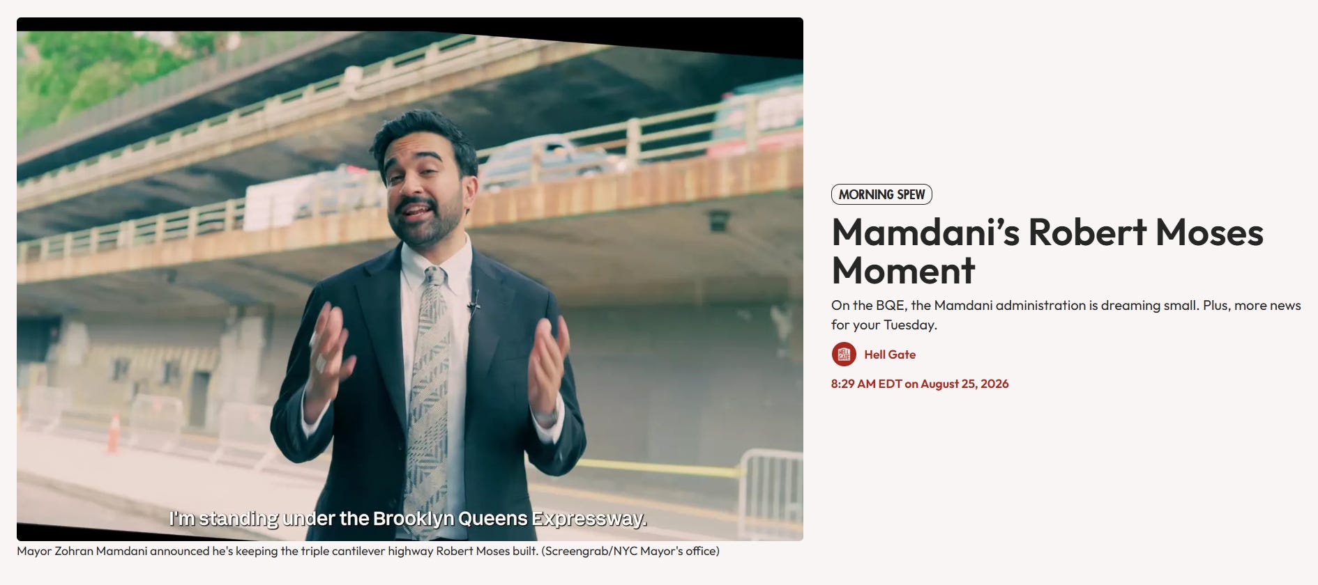
This is the correct take. If we rebuild the Central Spur to last another 50 years, we will have carbrained ourselves into “dreaming small,” and we’ll doom ourselves to repeat Moses’ mistakes forever. I know it seems like Mamdani’s team is positioning itself as if “we can just do stuff” is the answer all the time. We’ll have overplayed our hand and right into Moses’.
But, Sam, You Want The BQE to Collapse?
Certainly not, but if we assume the only solution to “problem” is rebuild and rebolster, then naturally the “preferred” option will emerge. This has historically been one dictated by the trades (roadbuilders, operators’ unions, etc.) or one that min-maxes effort; the path of least resistance.
No, of course I don’t wish for the BQE to collapse. I’m not one of these Emanuelian accelerationists1 heatseeking collapse to raise progress from the ashes. I am well aware of the practical limitations of planning and engineering wisdom versus reality and sentiment. I am trained in normative anchoring techniques and the counter-intuitiveness of most infrastructure development. But perpetuating the property, psychological, physical, environmental, and economic damage the BQE has done to Brooklyn and Queens neighborhoods in exchange for diminishing thru-mobility and car addiction in the densest city in the US is the planning equivalent of sending an infant to the gallows. The Belt becomes the Noose.
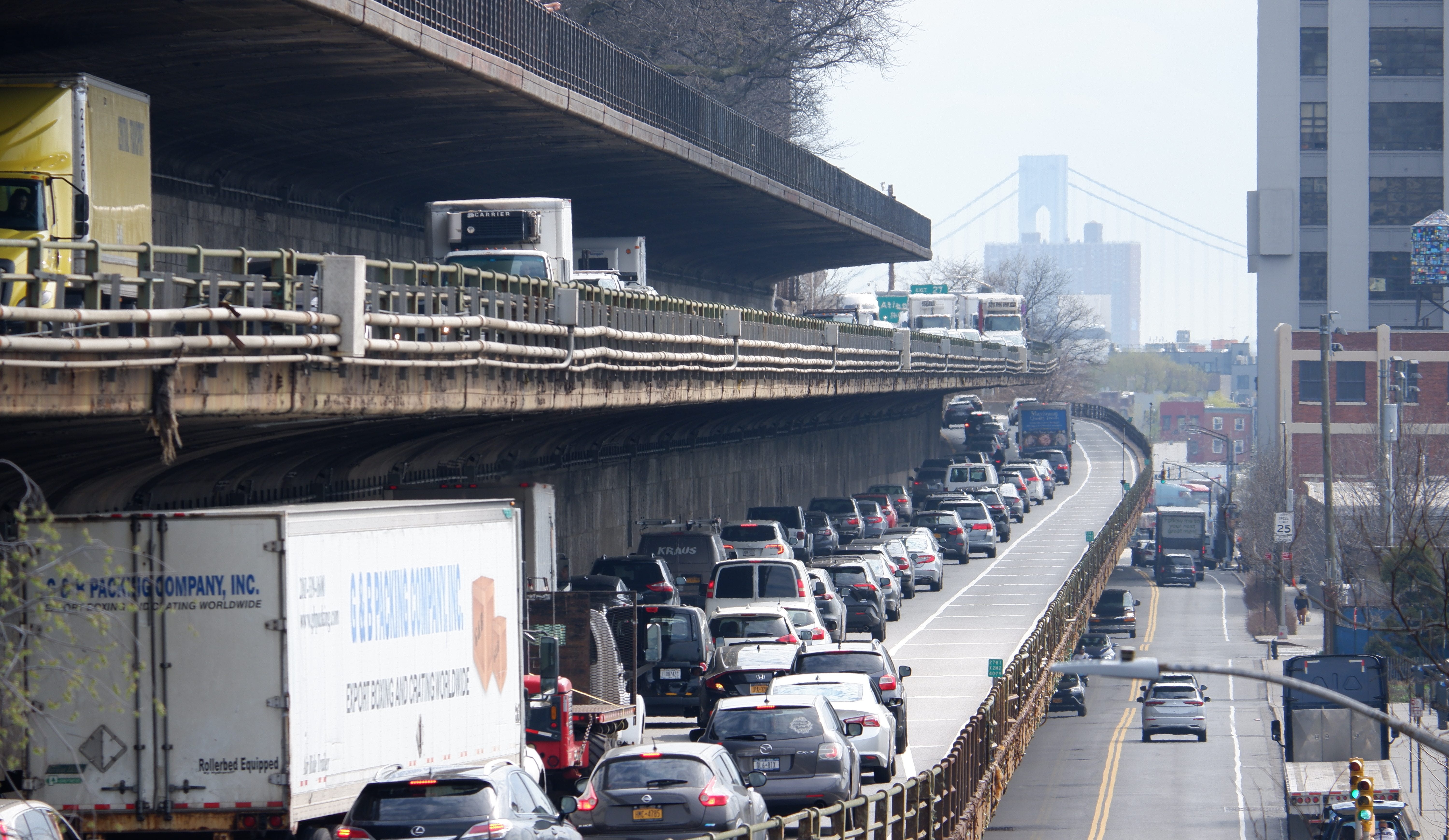
We must make sure the highway does not collapse; it’s been threatening for decades—the 50-year useful life has low-tanked us for the last twenty. Anything more than a bare minimum fix plus a vision that anathematically rejects the Moses vision of New York is, and is quite literally, highway robbery.
Instead, we must imagine a future that dismantles this infected scar and replaces it with a vision for mobility and access that doesn’t burden our children and grandchildren with a 100-year mortgage. There’s a reason banks don’t offer them.
But, Sam, What Can We Do? FAQs to answer all your questions.
I’ve also been taught (and told for Exasperated Infrastructures) that offering a problem without a solution is petulant and makes me a pain in everyone’s ass instead of indefinitely hireable and enjoyable to be around. So I’m going to structure this as FAQs that you’re surely asking yourself about my screed.
What problem are we trying to solve?
This is the quintessential question we must reason before passing qualitative and quantitative judgment on whether any alternative is the best2 path forward. What actual problem are we trying to solve? This question is the entire basis for the thesis of this very newsletter/blog/rantwheel. For example: if the problem we’re trying to solve is, “The cantilever is going to collapse imminently,” that generates one set of potential scenarios at different cost levels and timelines that focuses on repair. There’s another problem that reads closer to, “There is not enough capacity to handle future demand,” wagging the dog. There’s also another problem that defines the problem more broadly, “The BQE is loud, noisy, dangerous, and a parking lot,” so what is to be done?
Nearly endless iterations of problem design that planners and elected officials often skip when they want a politically neutral solution or a PR headline or the path of least resistance, but we can also ask ourselves what else is there if we abandon notions of “too hard” or “we can’t?” But without a problem definition, we’re going to be faffing about for the next 50 years chasing Moses’ ghost. Is that what we want? Really?
What are the alternatives for a “solution?”
It would seem that the problem Mayor Mamdani has landed on is somewhere between “The cantilevered highway is imminently going to collapse” and “we should prepare the city-owned section of the BQE for a much larger rehabilitation project,” which I think is a mistake. But given this problem ID, we can whittle the potential alternatives down. Let’s go through one by one. This section will be more of a comprehensive index than a full alternatives analysis.
There’s always a zeroth alternative: we could do nothing out of the ordinary. A null hypothesis is an essential part of the scientific method and needs to be included in any alternatives analysis. Note that business as usual is not the same as stopping activity on the BQE. This has been the status quo, and there is still a high likelihood that it continues.
The basic repair alternative: continue with smaller, but coordinated fixes with no future plan to renovate bigly. This alternative would be cheaper, but likely inefficient. It would keep the promenade open and continue normal operations, but one wrong order of operation and the project could fail. How do you price this risk into a maintenance plan? Costs would creep, and we’d be no better off.
The basic repair alternative with a plan to rebuild: this seems to be the administration’s preferred alternative. This would give the cantilever a facelift and build a new temporary?3 highway to divert traffic away from the triple cantilever…while it’s rebuilt as is to last indeterminately indefinitely?
The tunnel option: this would rip out or repurpose the cantilevered elements as a public space and bury the BQE section—meeting the trenched section that runs through the Columbia Waterfront District and Cobble Hill with a descent rather than an ascent. Think about how much the 2nd Ave Subway tunnel is going to end up costing. Do we want to do this for a tunnel that moves even fewer people per $million per hour?
The blue highway diversion: This involves a shift in supply to coerce the truck traffic off the BQE and onto our waterways for inter- and intracity goods movement. Irrespective of how we feel about the problem definition and how much we’ve moved digitally, we can’t (yet) eat data, so we need to figure out how to move goods differently anyway. Trucks cause a disproportionate amount of wear and tear on the roadbed and supporting infrastructure, so this would dovetail nicely with a basic repair alternative.
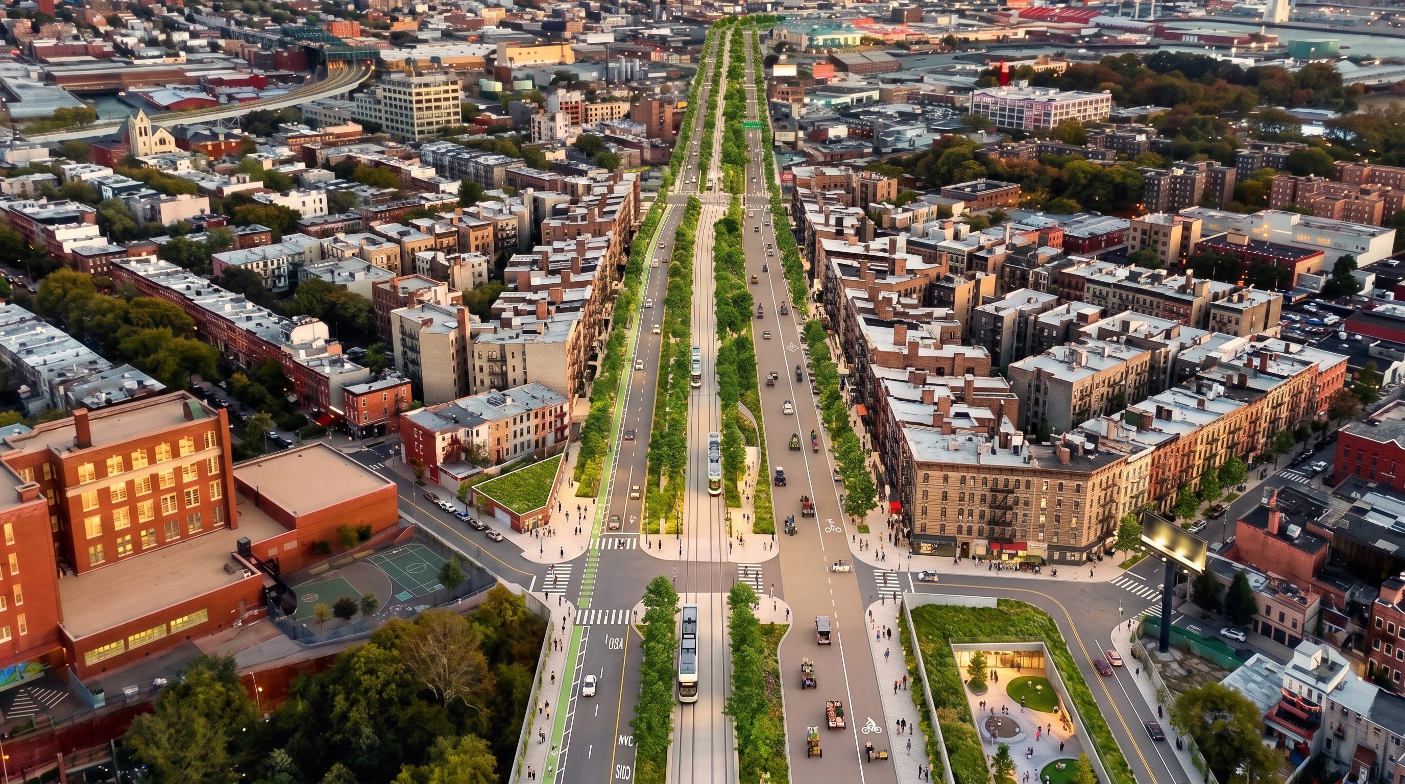
Rip the whole thing out and replace it with a hybrid boulevard and transit concept: If you don’t think the blue highway alternative is radical enough, why not explore the option that sounds nuts when first presented, but makes more and more rational sense the more you think about it. My friends at:
have some more to say about this.
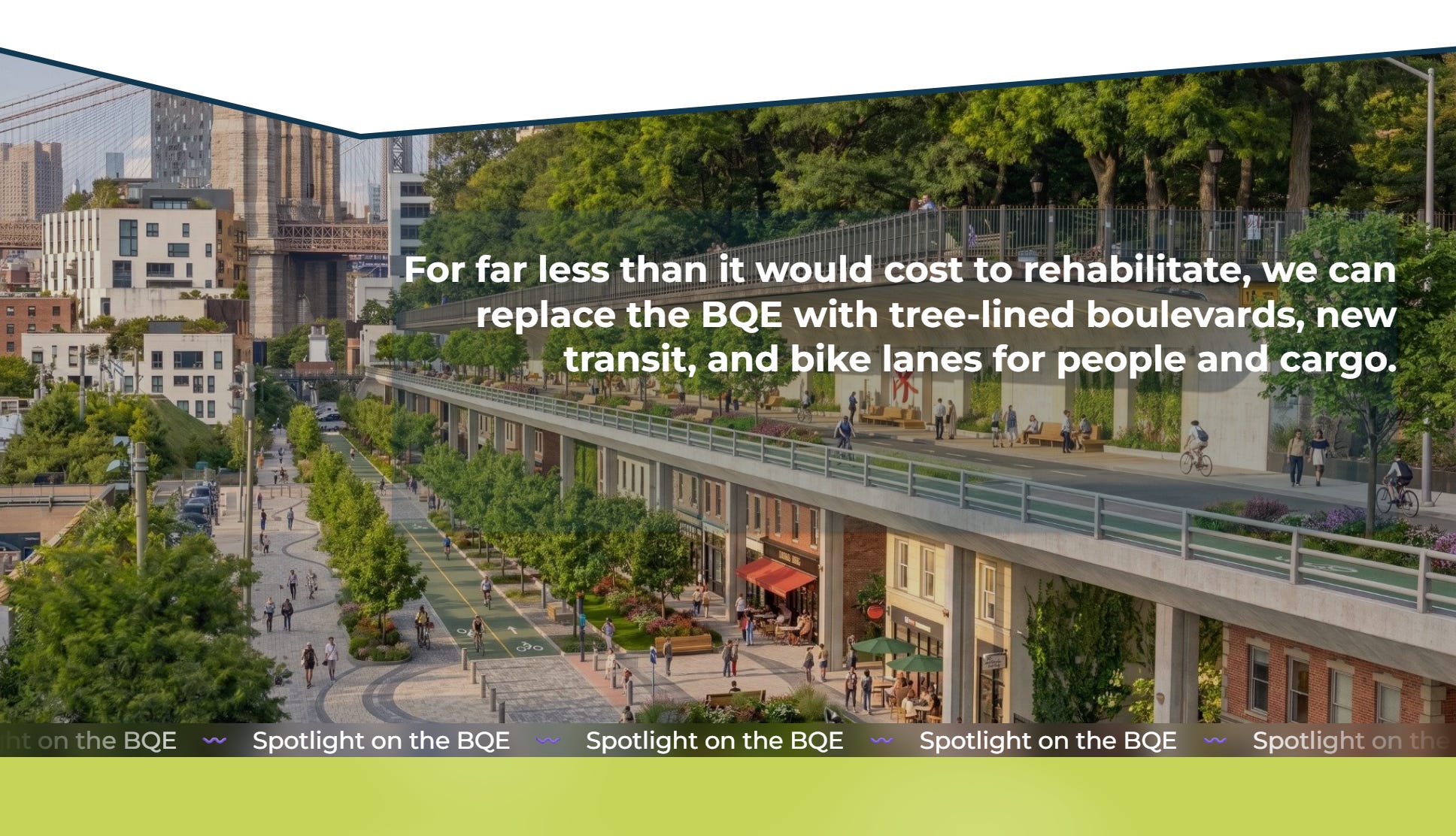
Note that none of the options here (except OFF-RAMP) consider the impact on the entire length of I-278 (BQE’s full Government) or what to do with this stretch of infrastructure that, too, will need major upgrades sooner than officials would like. And since we don’t really have a functioning high-capacity transit system4 that can handle this level of passenger influx5 in the event of minor or major system collapse, I continue to be terrified and hold my breath. At least the Mayor is doing something—but is the wrong something better than nothing?
How much will this cost? Against what benefit?
A lot of money, but money is fake, so who cares.6 That being said, we (New York City)7 will have to find the money to do this work. I saw an Instagram reel8 claiming this project will cost about $1 million per …foot, or around $4 billion all in.9 Add in the risk multiplier (delays are really expensive), and you’re looking closer to $5 or 6 billion. Now that number seems like a lot, and it is a lot, and that’s a totally different problem. But for the sake of argument here, let’s assume these costs to be true and a reasonable estimate. How do we know if this is a good deal? Two ways: measure the numbers against other, similar projects, and then against itself.
The first is benchmarking, which is an extremely important tool in planning, generally. This process is akin to comparison shopping, and it’s limited by market conditions, which may fluctuate, reflect a noncompetitive scheme, or otherwise not be calibrated correctly. But it’s always a worthwhile exercise to ground truth assumptions and, then, importantly, interrogate them to death. For this project, I’ll compare the cantilever renovation to both the Embarcadero Freeway removal in San Francisco in the late 1980s and the Alaskan Way Viaduct Replacement Project in Seattle. I’ll note a few differences and try to normalize as best as I can: instead of judging the full extent of the project, I’ll seek metrics that judge based on a per mile or per traveler or per-dollar basis. I’ll look to compare percentages—how much of the full extent of the project is this portion? Et cetera.
The next is benefit-cost analysis, which is itself a normalization tool. Sometimes economists will shorthand this as CBA or BCA, but the gist is twofold: the scale of the project is not relevant here. We seek to do an honest accounting using traditional time-value-of-money rules: a dollar today is worth more than a dollar tomorrow, and we want to know the cost of a project today.10 We also want to understand the project benefits: why spend at all? What are the quantified benefits of a project—in other words, what is its expected economic return? In infrastructure finance, we often measure success based on an increase in ridership or shipping fees, a decrease in time lost to delay, and, in saner times, the cost of carbon. We sum these two values: discounted costs and benefits, and compare them in a ratio. Any fraction greater than 1 is considered a worthwhile investment; any project less than 1 will have to prove its mettle in other ways (like its status as a collapsing cantilevered section of a major thoroughfare). Where BCAs get super fun is the supernormalization: we can then compare BCAs against one another or against a particular standard for projects, say 2.0, and prioritize them. We can even do a further superdupernormalization and build a full business case to justify a project’s existence.11 QED.
These two metrics together might tell us whether this project is worth its investment and to calm rightly affronted taxpayers’ fear that, yet again, we’ve Dug Big and flushed real dollars in pursuit of mediocrity.
“We finished this project on time,” is not an exclamation to be proud of, unless the project was worthy of our time, values, and money. It’s the standard we’ve set and still manage to come up short. Where is excellence?
What about the current traffic? Where will the trucks and cars go?
This is the biggest question I’ve gotten in my extensive and contentious text threads this week. Some estimates claim that peak BQE moves 130,000 motor vehicles per hour and about 10% of those are big-wheelbase trucks, you know, tractor-trailers. If we do decide to rip the BQE up and replace it, or even if we do this Moses-esque rebuild, the trips have to be distributed somewhere. We can do a trust me bro intuition test: residents will anchor in this idea that each and every one of these cars will be redistributed across the sleepy neighborhoods the BQE was supposed to bypass. This is rightly worrisome if it were remotely true (and it might be, bear with me).
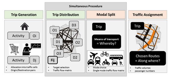
But we also expect that car and truck drivers (each) behave rationally and that with new mobility and accessibility options, trips re-sort themselves. Traditional traffic planning rationalizes this process into a four-step funnel, which, once I paste it below, should make sense if you haven’t seen it before. From TransitWiki, with my comments in italics:
Trip Generation
Trip generation determines the frequency of origins or destinations of trips in each zone by trip purpose, as a function of land use, household demographics, and other socioeconomic factors.
How do we figure out the trip gen? It’s a relatively straightforward process. There’s a manual or a local guide that will have a bunch of normalized tables classifying detailed land use type12 with some number that can be compounded based on population. Remember, this is all for the sake of a traffic model so planners can understand impact. ALSO remember: this is a major tool for traffic engineers to go/no-go on interventions. When you’re taught to believe your Bible as infallible, it’s hard to un-believe it.13
Fun fact: sometimes we call origins and destinations instead generators and attractors.
Trip Distribution
Trip distribution matches origins with destinations, often using a gravity model: a calculation that takes into account the relative activity at the origin and destination as well as the travel cost to go between them.
Makes sense for Step 2: once we know where trips are coming from and where they’re attracted to, draw lines between them, varying thickness based on volume and discounting them based on “cost,” which in this case is dollars (money), time (distance), and/or impedance (pain in the ass, like transit frequency or roadway construction or how much airports still suck). Most humans make quick decisions on where they’re going based on these factors and have built heuristics for repeat trips. Think how you know how to move from home to work and your intuition tells you that Trip A is quicker but more money and Trip B is more pleasant, but longer and cheaper.
This is the basics of trip distribution. We often describe them in pairs, aka “O-D Pairs,” for short. And can help us make sense of movement patterns.
Mode Choice
Mode choice computes the proportion of trips between each origin and destination that use a particular transportation mode. (This modal model may be of the logit form, developed by Nobel Prize winner Daniel McFadden.)
Mode choice is a fun one. It always takes into account reality: no assigning trips to “transit” if transit doesn’t exist—but we can model a “what-if” there was transit and try to understand a change in patterns based on, you guessed it, trip generation and trip distribution. In here also lie the mathematical modeling parameters for induced demand: “If you build it, they will come,” of sorts.
We often use “logit” regression modeling because mode choice is discrete and not continuous. In English: you can only be on a single mode at a time, and how you consume it changes based on distinct values. You can’t take half a trip the way you might consume half a bagel, and you can’t be on three-quarters of a bus depending on your desire to take a trip. Either/Or.14
It’s called a logit model because it uses binary logarithmic odds—the hypothesis is organized around “yes, I take transit (1)” or “no, I take another mode (0)” and the curve measures the probability that each mode (taking transit, walking, driving, biking) might occur and plots them on a scale between 0% and 100%…and not how much the act of taking a trip at all might change based on a series of other inputs (what you would use ordinary least squares regression for). Statistics lesson inception.
I hope this makes sense. Comment below if it doesn’t.
Route Assignment
Route assignment allocates trips between an origin and destination by a particular mode to a route. Often (for highway route assignment), Wardrop’s principle of user equilibrium is applied (equivalent to a Nash equilibrium15), wherein each driver (or group) chooses the shortest (travel time) path, subject to every other driver doing the same. The difficulty is that travel times are a function of demand, while demand is a function of travel time, the so-called bi-level problem. Another approach is to use the Stackelberg competition model, where users (”followers”) respond to the actions of a “leader”, in this case, for example, a traffic manager. This leader anticipates the response of the followers.
We know where people (or goods) are coming from, we know where they’re going, we know how many are going where, and how they might get there, but how will individuals behave based on this logic? That’s what route assignment is aiming to figure out.
This problem is counterintuitive and ultimately impossible to optimize in practice. Why? Because you can design a network for system optimization OR individual optimism. Think about your journeys. If you’re seeking to travel from point A to point B and the options are a wide (fast) highway or a series of narrower (slower) roads, what will you choose? Most individuals would choose the wide highway, optimizing their own individual utility, and they would be correct to do so if no other individuals also chose this option.
Remember impedance? Traffic is a system cost, and every additional system user adds exponentially to the TOTAL cost, even if each individual’s additional cost grows slowly. At some point the cost outweighs the benefit: the highway becomes a parking lot. The four-step model might suggest expanding capacity to meet the demand, but guess what happens?
Sam, what does this have to do with the BQE?
We’re doing middle-out four-step modeling, and it’s blinding planners to alternatives. Observed demand (~130,000 daily vehicle trips) outstrips planned demand (50,000 vehicle trips) that the BQE was designed to move—Moses cheers—and without knowing modern trip generation and trip distribution patterns, the bi-level problem rears its ugly head. If we start with the assumption that 130,000 trips must continue along this corridor in light of a new BQE vision, we must get the same outcomes. Where will the trips go if we rip out the BQE? They must clog local streets and ruin the idyllic Brooklyn Heights Experience—and everyone else’s, too.
Assumptiones delendae sunt.16
Given the information that the BQE will be torn out and replaced with a rapid transit boulevard, we can rethink trips through the four-step model (see above, which you just finished reading) and imagine a different future.
Trip Generation: This is a systemwide challenge and depends on how we define our system, and without more information about new housing and commercial (I hope) development along the defined corridor, the numbers may vary. We might assume the same scale: somewhere between 50,000 and 200,000 daily trips along the corridor on average. Where they’re coming from will follow similar trip gen patterns, but maybe…more.
Trip Distribution: Where people are going is changing from how the BQE was designed. Home-to-work trips, often shorthanded as HBW, home-to-other trips (HBO), and NHB (not home-based) trips are changing. Plus, with work-from-home options leveling out, we simply can’t assume that the same number of people are moving from the same places at the same rates and going to the same destinations as current models might estimate. NB: The census does a terrible job at reflecting non-work-based trips, household travel surveys are few and far between (they’re expensive), and we’re left with best guesses and perhaps now with powerful AI modeling, more accurate estimates about how people move to flesh out an agent-based model that treats each traveler as an autonomous cog in a system rather than part of a trend. Jury’s still out on this as “better” than traditional planning, but it may help the case here.
Mode Choice: With the addition of new transit options (IBX, Queenslink, BQE-replacement, plus reliability upgrades), a connected Brooklyn Greenway, the Bergen and Dean bike boulevards, and ubiquitous bike and ped infrastructure providing more options than ever—and they’ll keep growing—we’ll see a wider distribution of trips on different modes, further reducing demand for a double BQE (again, do we really think the city is going to tear out the new BQE diversion once it’s gone up? Maybe?) bypass.
Route Assignment: Given a future with a similar demand for travel across the boroughs, a more diffuse trip distribution times a broader mode choice, we have to think the need for a rebuilt 6-lane highway is not worth the investment and will mortgage us for very little benefit.
There will still be demand for a connection by car across Brooklyn and Queens. I am exasperated but not an idiot, and people will still drive on the roads we’ve already built to some extent, but we have the option to think more completely about a multi-modal system that assigns routes based on assumptions we no longer have to live by.
But, Sam, you still didn’t answer the question. Where will the cars and trucks go?
If Robert Moses figured a way to envision the BQE into existence, we, with the experience of hindsight, can figure out how to reroute traffic either out of their cars or out of the system entirely to make New York more resilient and sustainable as a place to want to be and move through and to.
The question above continues to be the question that will plague this post forever. If we can’t figure it out, then we are simply doomed to traffic and delay indefinitely. I know this is a vague answer and doesn’t solve the very real problem of overreliance on car travel and goods delivery. But assuming that they have to go somewhere is not thinking big enough.
Right now, certain trips, like a point-to-point Brooklyn-to-Upstate or even intraborough travel patterns, are easier by car, and the current BQE provides a mobility solution, but that’s a problem we know about and can define: “It is too costly, too inconvenient, and too slow to move around New York.” Adding the problem to the problem will solve this problem? In finance, investing more in a losing venture is often referred to as a moral hazard and is closely related to the sunk-cost fallacy: get out before you go too far deep that there’s no other choice but to keep investing.
That’s what this BQE “fix” is.
What can we expect for the future of American infrastructure planning given this project as a visible bellwether?
New York City has the bi-level problem of being simultaneously too complex to model Good infrastructure investing for other American cities and a necessary example of “If we can do it in New York, it can be done anywhere.” We must take a stand to think differently, to learn from our mistakes and also from proven strategies from Western Europe and Eastern Asia, in countries that still value a car trip, but don’t worship the motor vehicle above all and wouldn’t dream of rebuilding the BQE to its current standard when any other option is available.
This is actually a fascinating deep dive into tracking the chain of quotation of who said this, or something like it, first? Some trace it back to…Macchiaveli?
“Best” here is also suuuuuper subjective. Best according to who? My colleague Ryan Avent wrote a book about trusting others and normative lowercase-f faith recently, and it has had me thinking about how we’re both the most social and the least trusting creatures on the planet, which is a deadly combo at best. It has also had me thinking that at some point in this planning process, which will take decades to unfold and form for the future of the boroughs. Remember: we’ve lived on these islands way longer than the BQE has existed, and if you would have suggested the current BQE to someone in the 1910s, they would have asked you similar questions: but where will the horses* go?
*and electric trams
Do we realistically think that the City will tear this temporary highway down? You think Assemblymember Jo Anne Simon would say the same thing about that wishcasted project that she’s saying about this one: “It’s not visionary, but it is necessary,” but in favor of leaving the highway up? This leads me to my next point that I’m going to bury in the footnotes here. How do we, as a smart field, meet this moment? What I mean to say is, how do we make the economically sound choice the easy choice and the right choice and the only choice? Figure that out, and we’re in business.
The MTA runs transit in our city and region, and it is the best we’ve got, but it’s not set up for a major influx of customers, because the MTA’s system is, too, being held together with duct tape and a prayer that the problem becomes the next guy’s. Murphy’s Law is coming for us all.^
^That said, the system is an engineering marvel, and it’s a wonder it works at all, given its origins as three separate competing systems built at different depths with different loading gauges (width of the train) and happenstance connectivity. I’m only exasperated because we refuse to name the issue behind the “death spiral” coming for all transit in the United States: leadership and culture.
Oh, no, my steak is too juicy! My ice cream; too cold.
Relax, Jack and Josh.
For better or worse, the current thinking is to pony up the cash from City coffers to pay for this project. Foregoing state or Federal money means we can bypass the usual roadblocks, reviews, and approvals that attach themselves to that pool of money. The logic is that delivery velocity is more a crucial bellwether than exposure to outside capital. But building a bad project faster is somehow…worse?
So it must be true.
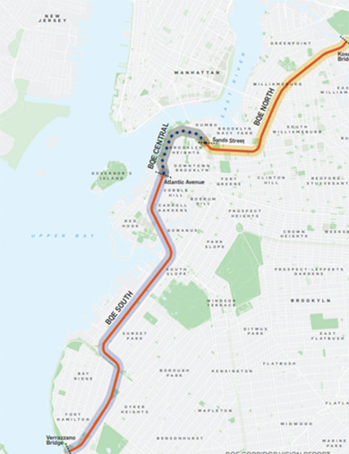
Also remember this is only for the BQE Central portion—a 1.5 mile stretch of an 11.7 mile highway. Normalization here is measuring the impact on 12% of the full highway.
The logic is nicely reflexive in this discounting process: if we use a particular rate of decay, called the discount rate in finance, we can determine whether it’s better to invest money in this project, another project, another version of this project, or no project at all. In this instance, a “project” could be municipal bonds, stocks, cash, or another investment. The point of doing this work is to attempt, as best as possible, to compare like to like.
Enough with these lazy, shorthand project prioritization matrices that don’t help an agency justify its spend and create trust among a skeptical public.
As in different-sized apartment buildings would “generate” more trips, but where the apartment complexes are located (how far from the commercial core) and what a typical household may look like (how many cars a household is likely to own, median income, etc.) matters too.
Though if you’re also taught to reason into a position, reason should also be enough to de-position. Alas.
Though A Beautiful Mind is a terrible movie. Best Picture? Yikes.
Assumptions must be destroyed; Carthago delenda est redux.
I generally agree with your post — I think your argument on framing makes sense. I would say though, that after years of collapse warnings, I'm happy that we'll at least avoid that. A bare minimum fix is what we have right now, and I'm not sure there's a safe way to keep kicking the can down the road — the 2020 Expert Panel found spans already falling below reliability requirements, and your own point on the basic repair option ("one wrong order of operation and the project could fail") is regrettably correct.
The blame for never seriously investigating alternatives lies in the last twenty years, but for the cantilever itself I think it's too late now. Fortunately, the rest of the BQE can still be modified!
Great analysis. Repairing as is or anything that preserves the BQE in its current form would represent the worst planning decision since the destruction of Penn Station.
One issue not mentioned is the brutal impact on the buildings adjacent to the BQE that already suffer from the noise and pollution from the highway. A “temporary” roadway over Furman Street would cause hundreds of millions in lost property values; inverse condemnation proceedings would cost the City a ridiculous amount.
The BQE should never have been built as it is. Recreating an innovative design that was, nonetheless, utterly inappropriate 80 years ago so that traffic can flow until the 22nd Century would be a monstrous decision.